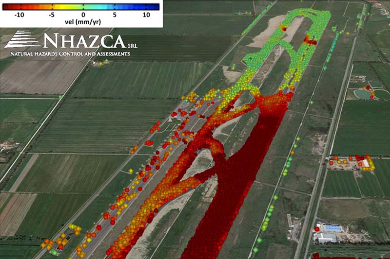
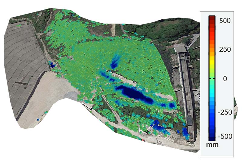
Geotechnical or mining activities give rise to surface displacements, particularly over periods of short or long term. Observations of such deformation provide a powerful tool for mapping construction parameters within the ground, providing new insights into the geotechnical site or mining operation dynamics. We use Interferometry Synthetic Aperture Radar (InSAR) range changes to infer surface or subsurface dynamic operation within the site. Furthermore, we conduct a complete model assessment, using static or pseudo-static approach to compute model parameters.